
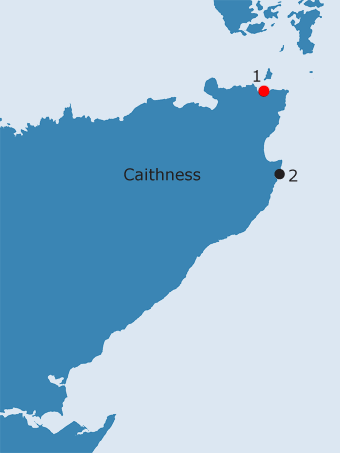
CAITHNESS: C1. Papel, Canisbay · Introduction Just offshore from the parish church at Canisbay is an almost circular rock known as Papel, which is only visible at low water (NB, Caithness, Book 2, 65; George Watson, pers. comm.). The name is depicted on none of the earlier maps consulted in this study, but is noted on the map included in Mowat’s account of the place-names of the parish, although it is not discussed in the text (Mowat 1933). In 1791, the church at Canisbay is described as being in the centre of the parish, ‘on a green rising ground, close by the shore’ (Morison 1791, 152). The present village of Canisbay is set some distance inland from the church, but originally used to surround it (Mowat 1933, 153). The church, first mentioned between 1223 and 1245 (RCAHMS 1911, 7-9, no. 23; NMRS/SMR no. ND37SW4, ND 3434 7285), is built on the remains of a broch mound. Joseph Anderson investigated the site in 1890:
Finds from the graveyard, including red deer antler and hammerstones, are now in the NMS (PSAS 1873, 248; SMR nos. ND37SW5 and 32, ND 3434 7285). This association, along with the generally accepted dedication of the church to St. Drostan, would suggest that Canisbay is an early medieval foundation (Scott alone says that the church is dedicated to St. Anne (FES, Vol. VII, 116)). According to Beaton (1909, 48), the original chapel lay to the north of the present site and was known as ‘Kirk by the Sea’. He states that the site of the chapel is discernible, but it seems more probable that he is refering to building footings between the church and the Papel rock, which are said to be an Old Distillery on the OS First edition map (SMR no. ND37SW18, ND 3428 7297). The distillery was founded c. 1826, as a means of providing work for the sons and tenants of George Sutherland, the owner of the farm of West Canisbay (Houston 1996b, 345). Having spent £800 on constructing a malting kiln, a corn kiln and the distilling plant, he lamented in a letter to one of his sons that he had never got a single dram from it (ibid.). All that is left of the distillery is a length of walling, red roof tiles and some scattered bricks (ibid.). Associated with these buildings is a small quarry (George Watson, pers. comm.), while a well is also noted on the OS First edition. Lyrequoy, the name of another well, just to the north-west, means ‘the clay fold’ (Mowat 1933, 178). On the modern map, the area of the distillery is called Slayel, (suggested to be from the Norse sly áll, a narrow inlet often filled with seaweed, ibid.).31 Other names along the shore, such as Scaabank (now Sea Bank), a small sandy bottomed channel, incorporating the ON skaggi, a low ness, and bakki, a bank (ibid.), seem to be topographically descriptive. This area was known as Gills, understood to be a corruption of Kills, but more likely to be from ON gill = ravine (Beaton 1909, 48). The church was assigned as a prebend of Dornoch cathedral by Bishop Gilbert in his constitution of the chapter in 1224 x 45 (OSR, no.9; Cowan 1967, 26). Both the parsonage and the vicarage continued to support a prebendary, while the cure was served by a vicar pensioner (ibid.). The parish was ‘at one time’ divided into districts. Mey included St. John’s Point at the north-west boundary of the bay where there is a chapel located within a prehistoric fort. When it was excavated in 1919 a cross-slab was found which had been re-used as a side-slab in a stone-lined grave which may be tenth century or earlier (Fisher, 2002, 45). Other chapel sites are St. Maddan’s at Freswick, St. Tustan’s (probably Drostan) at Brabster, St. Mary’s at Duncansby (Jolly 1840, 25) and a ‘chapel and burying-place’ at John of Groat’s House (Craven, l886, 204). Within this scheme, the parish church served only the adjacent district (ibid.). A slightly earlier description of the parish adds to this the two chapels on the island of Stroma ‘called commonly the Kirk of Stava and the Kirk of Old Skoil’ (Anon. nd., 156), while St. Irchard’s Chappell is mentioned in the Fasti Ecclesiae Scoticanae as a place of pilgrimage in post-Reformation times (Vol. VII, 116; Vol. VIII, 676). There is also the possible hermitage at Strubster, on the boundary of Canisbay, Wick and Bower parishes (Anon. nd., 156; see below).
The application of the name Papel to a rock is another of these names for coastal features from which it is difficult to draw any significance for the pre-Norse ecclesiastical situation. It is however different from the others in indicating a Papil site with habitative connotations rather than a topographical name like Papigeo (below). It may be a toponymic survival of a ‘papar’ settlement somewhere round the Bay, and the most likely place would have been at St. John’s Point, where one piece of early sculpture has been re-used in a later grave, and where there is the best land in the vicinity.32
· Soil Survey: Class 42 (only at the headland of St. Johns Point)
OS maps:
|
|||||||||||||||||||
| 31More likely to incorporate völlr (= level field) as its second element (ed.) | |||||||||||||||||||
32The session records, dating back to 1652, are the second oldest in Scotland and may well contain a wealth of evidence for the survival of superstitions and traditional customs. |
|||||||||||||||||||
)