
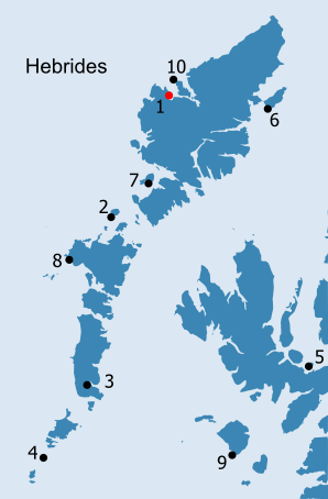
HEBRIDES: H1. Pabay/Pabaigh (Uig, Lewis) See inventory of place-names in the vicinity of Pabay/Pabaigh (Uig, Lewis) in Place-Name Appendix H1 · Introduction 'There is nothing certain known of the early history of the pre-Reformation churches in the Outer Hebrides. It is inferentially clear, from the existence of the different islets, named Pabbay, or Priests' Isle, that prior to, or during, the Norse occupation, they were chosen by Christian anchorites as fit places for meditation and prayer ; and it is not unlikely that, in the conversion of the rough Northmen to Christianity, these lonely hermits, who were held in high esteem, may have played a part of some importance' (Mackenzie 1903, 518). Pabaigh Mòr centred NB 1017 3797 Made up of smooth sandy beach, rock, and flowery pasture, Eilean Pabba has much of that peculiar sweetness of aspect which somehow invariably belongs to islands of the name. But, besides its picturesque beauty, there is nothing in it deserving much notice,-a copious fountain issuing from a moss-covered stone cell, a capacious cavern, in which the benighted fisherman often seeks repose, and the scant remains of St Peter's chapel-a rude and narrow oblong some eight-and-twenty feet in length in the middle of a nearly obliterated burying-ground-being the only objects of interest (Muir 1861, 177). Pabaigh Mòr and Pabaigh Beag lie at the south western corner of Loch Roag, off the north west coast of Lewis. The much smaller Pabaigh Beag lies to the north of Pabaigh Mòr, separated only by a narrow sound, Caolas Pabay Beag, which widens in the centre to form an excellent, sheltered (albeit shallow) harbour, the reputed haunt of pirates (Haswell-Smith 2004, 310, quoting the West Coast Pilot; Figs. H1.1 and H1.3). In turn, both islands are separated by another sound, Caolas Phabaigh, from Bhaltos and Cnip to the west. A number of smaller islands surround them, including to the east, Great Bernera/Beàrnaraigh Mòr and Little Bernera/Beàrnaraigh Beag - the latter containing another 'papar' place-name on its east side, on the opposite side from Pabaigh (see H10). Both Pabaigh Mòr and Pabaigh Beag, though not always named, appear on many of the early maps (Fig. H1.2), a reflection of their visibility from the sea routes passing along the west coast of Lewis: The shore around this island is partly low and rocky, and at a distance marks a prominent feature on the western shore of the Lewis. It is nearly in a straight line with the Butt of Lewis and Gallon Head and separated from the land by a narrow channel called Caolas Pabby. Around this island is famous for the fishing of Cod, Ling, Herrings, Turbot, and Lobsters &c. the ? height of tides at this island is from 12 to 15 feet. The wind blows 2/3 of the year from the North west and south west (Ordnance Survey 1850-3, Original Object Name Books, Ross-shire, Book 42, 27). Pabaigh, lined up on Conistoun Hill on the north side of Loch Roag, was also used as a fishing mark for the Beàrnaraigh boats fishing off the Flannan Isles (MacLeod 2005, 105-13). Loch Roag, defined by Gallan Head to the south and Aird Laimisiadair to the north, provides a safe haven on the west side of Lewis: About 24 Miles South-west, lyes Loch-Carlbay [usually referred to as the north east branch of Loch Roag], a very capacious, tho, unknown Harbour, being never frequented by any Vessels : Tho' the Natives assure me that it is in all respects a convenient Harbour for Ships of the First rate. The best entrance looks North and North-west, but there is another from the West. On the South side of the Island Bernera, there are small Islands without the entrance, which contribute much to the security of the Harbour, by breaking the Winds and Seas that come from the great Ocean. Four Miles to the South on this Coast, is Loch-Rogue, which runs in among the Mountains (Martin Martin 1703 (2003), 4). Like Martin Martin, many of his contemporary travellers who came to Loch Roag saw it as large enough to safely harbour the entire British fleet - if not every ship in Europe (Monro 1792-7, 283). However, it was the complexities of navigation amongst its many islands which struck Macculloch most forcibly: This inland sea is crowded with islands, among which, the great Bernera is six miles long ; but many of them are very small. While the shores are deeply indented by bays and promontories, the water is so beset with these islands, that it requires no small effort of attention and care to navigate it. With plenty of time to spare this navigation is very entertaining ; the pleasure may not unaptly be compared to that of discovering ænigmas ; from the exertion of ingenuity which it requires. But there is nothing picturesque, as the cliffs are without beauty and there is an utter want of wood. From the violent contrasts of red, white and black, the rocks look like marbled paper ; as if Nature had here sported in painting her own works, for the entertainment of some haberdasher in taste: an effect produced by contortions of the red and white granite, and gneiss, and of the black hornblende of which they are formed. My seamen were soon obliged to resign the pilotage, as beyond their powers ; and the task of course devolved on my hand. Impudence is a very useful virtue . acquiring by it, from my Captain and his crew both, a confidence that gave me access to a thousand places which I must otherwise have been content to abandon (Macculloch 1819, 225-6).
Besydis this ile [Vaxay] lyes Pabay, an ile maire nor ane myle lange, ane fruitfull and fertile mayne ile, full of corne and scheipe, quherein ther was a kirke, quherein also M'Cloyd of the Lewis ussit to dwell, quhen he wald be quyeit, or yet fearit. This ile is guid for fisching, and perteins to M'Cloyd of the Lewis (Monro 1549 (1994), 520). Dean Monro's emphasis on Pabaigh's fertility provides a contrast to the bleakness implied by Macculloch, but his densely inhabited island, self-sufficient in its own resources, is perhaps a more accurate representation. The Name Book account is similar: A very large island, in Loch Roag composed in general of very good rocky pasture, with several small patches of arable land here and there. There were seven families living on this island formerly, but there are none at present. There is the ruins of a very small church to be seen here seemingly built in proportion to the population of the island (Ordnance Survey 1850-3, Original Object Name Books, Ross-shire, Book 42, 27). Though Pabaigh was not the only island in Loch Roag to have acted as a Macleod refuge (Murchison 1958, 294-5), it would seem an ideal west coast stronghold, as it is located close to some of the most densely populated areas in this part of Lewis. A seventeenth century description appears to hint that the principal base of the Macleods (not just on the west coast) was in the parish of Uig; the only place specifically mentioned in this account is Pappa (Anon. c.1630, 184). According to the author of the Old Statistical Account, 'Uig, in the common acceptation of the word, signifies, in many parts of the Highlands, a solitary place, much sequestered from the public eye' (Monro 1792-7, 280). One of the mottos of the Clan Morrison is Teaghlach Phabbay, 'family of Pabaigh', perhaps deriving from the Morrisons who were hereditary brieves to the Macleods of Lewis, rather than the branch who were armourers to the Macleods of Pabaigh, Harris (cf. Morrison 1956). Pabaigh Beag In contrast to Pabaigh Mòr, Pabaigh Beag is far more barren and rocky in appearance: A large rocky island in Loch Roag. The shore of which is bold rough steep and very uneven, with a number of small creeks in several of which there is no low water mark. It is difficult to land on any part of this island, when the wind is from the north-east or west. There are a number of low water rocks round it which causes it to be so unsafe for boats to come near (Ordnance Survey 1850-3, Original Object Name Books, Book 42, 8) Only one archaeological site has been recorded on Pabaigh Beag (see below), but the OS First edition map shows a number of walls on the island and it seems probable that it was regularly utilised, at least for pasture (Fig. H1.4). The place-name, Laimhrig an Aisig, meaning "Ferry Landing Place" (Ordnance Survey 1850-3, Original Object Name Books, Ross-shire, Book 42, 16), on the south side of the sound separating the two islands, does suggest that traffic between the two Pabaighs was fairly frequent.
Like most of Lewis, Pabaigh Mòr and Pabaigh Beag are underlain by gneiss, although a small metabasic dyke clips the north west side of Pabaigh Mòr and runs up the west coast of Pabaigh Beag. The gneiss is overlain by peat and peaty soils, though a large area of machair has formed at the south east corner of Pabaigh Mòr, where the township of Briomanish was located (Figs. H1.5 and H6.6). In modern land capability classifications, Pabaigh Mòr is only classified as 6/3, (rough grazing quality) with a small area of 6/1 on the machair. However, a number of arable areas are mentioned in the Name Book, and lazy beds are visible on aerial photographs on even the sour ground to the north and west of Loch an Teampuill (e.g. RCAHMS E5430-31). Headrick believed Pabaigh Mòr was once larger, because he found a layer of shell-marl under the blown sand (1800, 10). Though there is no other evidence to support this, it is possible that sand blow over the last couple of centuries has depleted the area of ground available for cultivation. A number of place-names recorded on the OS First edition map support the importance of the grazing on Pabaigh. Sgeir h-Aon Chàorach, One Sheep Rock, off Traigh na Cille, which had 'little or no vegetation on it', could still support one sheep, presumably confined on here during the summer months (Ordnance Survey 1850-3, Original Object Name Books, Ross-shire, Book 42, 30; Fig. H1.6). There is a Geodha na Bà, cow's creek, on the north west corner of Pabaigh Mòr, while two buaile or enclosure names on the south east side of the island, also confirm the presence of animals (ibid., 22, 32). By the time the Ordnance Survey began collecting place-names, the island had been abandoned and it is probable that this biased them against collecting settlement names. A cave on the north east corner of the island was used by fishermen, both for shelter and to cure the salmon which they caught, at least in the later nineteenth century (ibid., 15; Muir 1885, 57; SMR no. 8489). Tòb Pabaidh, two large tidal ponds on the south side of the sound separating Pabaigh Mòr and Pabaigh Beag, may be the lobster ponds referred to by Macleod (1997, 25), while only lobsters could be found at Traigh na Cille on the east side of the island (Ordnance Survey 1850-3, Original Object Name Books, Ross-shire, Book 42, 21, 29).
A crouched inhumation was excavated on the southern slopes of Méathannan, the rounded hill immediately to the north of Loch an Teampuill (Barrowman 2002; NMRS no. NB13NW 57; NB 1048 3795). The burial did not have either a cist or a covering cairn, but next to a large headstone at the west end of the burial was an almost complete, broken pot, which may be of Bronze Age date. Middens are exposed along the shoreline of Traigh na Cille, although these have not been dated (SMR no. 8429; NB 1053 3794). The wealth of archaeological evidence from Cnip and Bhaltos and elsewhere around Loch Roag, suggests that it was central to the Late Iron Age and Norse occupation of this area (e.g. Armit 1994, 1996, 2002, 2003; Barrowman 2005, Site 16). There are two topographical names on Pabaigh Mór which incorporate the ON bólsta?ir (= 'farm') element. Cnoc Chàrraboist/Garrabost, which is described as a small rocky hill on the north-west side of the island, forms the south side of the lagoon between Pabaigh Beag and Pabaigh Mòr (Ordnance Survey 1850-3, Original Object Name Books, Ross-shire, Book 42, 18, 21; Gammeltoft 2001, 117). Mèalabost, 'a small round hill of rocky pasture' on the eastern side of the island (ibid., 26), lies immediately to the north of Traigh na Cille; there are a group of cairns within an enclosure on the south side of the hill (SMR no. 8430; NB 10448 38046). See Indicators of Ecclesiastical and Norse Settlement and History
in the Toponymic Material in Appendixes H1-H8 by Dr. Richard A.V.Cox The massacre of the Macaulays by the Macleods of Pabaigh, c. 1480 (MacDonald 1967, 14-8) - in conjunction with the stories of Macleod of Lewis's hideaway on the island - suggests that the island remained a focus of settlement throughout the medieval period. One of the stories most closely associated with Pabaigh, that of the Sergeant Mor, who liberated a cargo of whisky by shooting the captain of the ship, provides a colourful account of the abandonment of the island in the nineteenth century (ibid., 160-2). Fearing the wrath of the captain's family, the four families remaining on the island abandoned their homes for crofts in Bhaltos. The buildings of the township of Briomanish are shown as roofed on the OS First edition map (1854), but are annotated as 'ruins'. Although the buildings are depicted rather differently on later editions of the OS map and the people of Bhaltos did continue to use the island for winter pasture, it is probable that the island was never permanently occupied after the mid nineteenth century.
Central to life on the island must have been St. Peter's church, which lies on the east side of Pabaigh Mór, immediately to the south of Traigh na Cille, one of the better anchorages on the island (Haswell-Smith 2004, 310; Fig. H1.7). Monro's mention of a church on Pabaigh suggests that it might date back to the medieval period, while Martin Martin - who is the first author to note the dedication - includes it in his list of churches on Lewis, implying that it may still have been in use at the turn of the eighteenth century (1703 (2003), 27). The first Ordnance Survey surveyors saw the small size of the building as being in proportion to the population of the island, describing it in the Name Book as 'the ruins of an old church which has no name' (Ordnance Survey 1850-3, Original Object Name Books, Ross-shire, Book 42, 34). Though shown as roofed on the First edition map and lying within an oval graveyard, T. S. Muir describes the remains of the church and graveyard as very slight in 1859 (see above and 1885, 57; Fig. H1.6). Following a visit in June 1914, the RCAHMS describe the chapel in more detail, but do not mention the graveyard:
The fact that the church is not on a perfect east-west alignment does not preclude this being the original pre-Reformation building, particularly given that there is nothing else in the RCAHMS description which provides any hints as to the date of the building. Its dimensions are only slightly smaller than those of Teampull Mhòire on Pabaigh, Harris, which does appear to have remained in use following the Reformation and which may postdate the earlier, medieval Teampull Bheag (see H2). In 1969, the OS surveyors noted a window at the east, not the west, end of the south wall and the turf-covered footings of what may have been a chancel, the latter giving some weight to a medieval date. More recently, it appears that much of the sand has been removed from the chapel and its surroundings; the chapel itself has also been cleared out and parts of the walls rebuilt (Barrowman 2005, 44-5, Site 16). The church now appears to be sitting on a mound, which may be the remains of earlier settlement, although it seems equally likely to represent the build-up of graves over time. In 2001, the Western Isles Archaeologist noted that 'a few plain marker stones are visible in the turf of the surrounding mounded slope' (SMR no. 143). The graveyard appears less clearly defined on the OS Second edition map (1898) and does not appear at all on the more recent editions of the large scale OS maps (1974, 2003). Many small islands like Pabaigh seem to have been viewed as special places, set apart from the everyday world and remaining in use for burial even after their churches had fallen out of use (Barrowman 2005, 59; see below, H10). Additionally, Pabaigh is noted in the second Statistical Account to have been a nunnery (Macleod 1833, 153). A number of small structures of varying form, some of which are corbelled, have been identified on a headland on the south side of Pabaigh Beag (SMR no. 9701; NB 09793 38873). A site at Mealister (Mealastadh), on the coast south west of Loch Roag called Tigh na Cailleachan Dubha, 'The House of the Old Black Women', is described in the early nineteenth century as a nunnery (Monro 1792-7, 288; Macleod 1833, 153; Barrowman 2005, 55-6, Site 21). There is little to support the place-name at Tigh na Cailleachan Dubha and the identification of a nunnery may be a misunderstanding of the Gaelic name. However, there is a more likely early monastic site at Tigh Bheannachaidh, 'The House of Blessing', on Gallon Head, at the western point of Loch Roag where up to twelve cellular structures, reminiscent of those on Pabaigh Beag, are clustered around a small chapel (Barrowman 2005, 46-50, Site 18). Teampull Pheadair (St. Peter's church) lies on the north side of Cnoc na Cille, 'a small rocky arable hill', with Traigh na Cille and Sgeir na Cille to the north (Ordnance Survey 1850-3, Original Object Name Books, Ross-shire, Book 42, 29, 31, 34). The small stream which runs along the north side of the chapel issues from Loch an Teampuill, a small fresh water loch in winter, which dries up to a marsh in summer (ibid., 34). In addition to these place-names, which all seem to attest to the significance of the church, the name, Crois (= 'cross'), for the most southerly point of the island, is an unusual name for a headland (ibid., 42; Doreen Waugh, pers. comm.). There is a Gob na Crois and a Cnoc na Crois to the east of Teampull Chiarain at Laimisiadir, on the north side of Loch Carloway and in sight of Teampull Beàrnaraigh Beag (see H10; Barrowman 2005, 32-3); it seems possible that a cross in this position would have marked the point where the chapel first came into view. A similar explanation may underlie the place-name on Pabaigh Mòr.
Loch Roag forms the heart of the parish of Uig and, just as settlement is concentrated around its shores and on its numerous islands, there are also a number of chapels, potentially of early date, scattered around it, as well as along the coast of Lewis to the south. Uig formed one of the four parishes of Lewis, during the medieval period, these declining to two - Barvas and Ui (Eye) - following the Reformation (Monro 1549 (1994), 521; Martin Martin 1703 (2003), 27-8; Mackenzie 1903, 524; Cowan 1967, 64, 136; Macaulay c.1984, 18). Uig was linked with Ui until the beginning of the eighteenth century and it is probably in this period that many of the early chapels may have fallen into disuse (FES vii, 207; Macaulay c.1984, 18; Mackenzie (1919, 147) believed it to have been conjoined with Barvas). Martin Martin lists seven chapels in Uig, including St. Peter's and Teampull Dhonain and Teampull Mhìcheil, the two chapels on Beàrnaraigh Beag associated with the other 'papar' place-name in the parish (1703 (2003), 27-8; see H10). Of the remaining chapels, the parish church, dedicated to St. Christopher or to Christ, lay at Balnacille on Uig Bay, to the west of Pabaigh and Bhaltos and facing the Atlantic (Barrowman 2005, 50-2, Site 19). There was a chapel dedicated to St. Macrel at Circebost on Bearnaraigh Mòr, although the present church would seem to be of later date (ibid., 40-3, Site 15). There is another St. Michael dedication at Ciribhig and one to Ciaran at Laimsiadair, both near Chàrlabhaigh, at the north east corner of Loch Roag. Teampull Mhìcheil is thought locally to have been built after St. Michael's chapel on Beàrnaraigh Beag, when it was not possible to transport bodies to Little Bernera for burial; initially it was only temporary, but later became a permanent burial ground (Information contained in SMR record; Barrowman 2005, 37-8, Site 12). To this list can be added the chapel at Mealastadh, along with another unnamed chapel at Bhaltos (Barrowman 2005, 45-6, 53-4, Sites 17 and 20). Apparently associated with the chapel at Mealastadh was a shrine to St. Catan, while Tigh na Cailleachan Dubha lies to the south (Mackenzie 1919, 137-8; Barrowman 2005, 55-6, Site 21). The Flannan Isles (twenty-one miles west of Lewis at 58 17N), as with many of the small, remote isles, appear to have been considered especially sacred, the rituals carried out on landing on the island surviving long after the Reformation (Martin Martin 1703 (2003), 16-9; Monro 1792-7, 283; Macleod 1833, 151, 153).
OS maps: Institute of Geological Sciences, 1981. 1:100,000. The Outer Hebrides. Lewis and Harris North. Solid Edition. Soil Survey of Scotland, 1982. 1:250,000. Sheet 2. The Outer Hebrides. Soil. The Macaulay Institute for Soil Research Aberdeen. Soil Survey of Scotland, 1983. 1:250,000. Sheet 2. The Outer Hebrides. Land Capability for Agriculture. The Macaulay Institute for Soil Research Aberdeen. Soil Survey, Class 6/3, except for a small area of class 6/1 at the south eastern tip of Pabaigh Mòr.
This is one of two 'papar' islands on the west coast of the northern Outer Hebrides (the other being H2), and it is an important and conspicuous example of the genre. A prominent landmark for those travelling by sea, it guards the southern access to the sheltered waters of Loch Roag. This island has features which indicate an ideal situation for an early Christian community. It is very marginal in its location on the western fringe of the whole of the Scottish island chain, with a separate, even more marginal, island of Pabaigh Beag providing an ideal situation for a hermitage. Some recently-recorded circular structures on Pabaigh Beag may even be the remains of early Christian cells. However, this marginality could also have provided a very strategic base for sea raiders, with the channel between Pabaigh Mòr and Pabaigh Beag forming an excellent harbour for boats with shallow draught. This is also reputed to have been a haunt of pirates in times past and Pabaigh was used a refuge by the MacLeods according to Martin Martin, and may even have been one of the clan's main bases on the west coast of Lewis. Its usefulness as a refuge and pirates' lair might point towards a similar usefulness in Viking times. The island's fertility meant, of course, valuable food resources for all resident and transitory populations and the remnant bólsta∂r names provide an indicator of former Norse farms on the island. |
|||||||||||||
)
)
)
)
)
)
)