
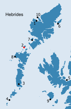
HEBRIDES: H2. Pabbay/Pabaigh (Harris) Download appendix for this chapter - 'Pabaigh 2005: Soil Survey and Sampling by Jo McKenzie' (130KB) See inventory of place-names in the vicinity of Pabbay/Pabaigh (Harris) in Place-Name Appendix H2 · Introduction
Teampull Mhòire NF 8893 8697 Teampull Bheag NF 8892 8698 |
|||||||||||||||||||||||||||||||||||||
Introduction Both of the 'papar' place-names in the parish of Harris are located on two of the larger islands off the west coast of Harris. However, in contrast to the settlement name of Paible/Paibeil on Taransay/Tarasaigh (see H7), the 'papar' have given their name to the entire island of Pabaigh (Fig. H2.1). The triangular profile of the island dominates the west end of the Sound of Harris/Caolas na Hearadh, the only means of passage between the Long Island and the southern chain of Outer Hebridean islands (Fig. H2.2). Its prominent position off the west coast of Harris is clearly important in understanding its early history (cf. Knox 1787, 156-7). The Macleods of Harris used the island as a power base until the early 1500s (Morrison 1978, 90; Lawson 1994, 3); the existence of their castle perhaps accounts for the prominent settlement symbol on Papa recorded in Blaeu's Atlas (Fig. H2.3). First noted by Martin Martin, the steward for St. Kilda resided on Pabaigh in the early modern period (Martin 1703 (2003), 48), a practice which still continued in the early nineteenth century: The St Kilda Tacksman usually takes a boat from Pabba when he pays his biennial visits, both from it being a few miles nearer, and independent of the difficult rocky navigation of the Sound, and because the people of Pabba boats and men are better adapted for the purpose - moreover it is the near next habitable point to St Kilda, being within sixty miles of it (George Clayton Atkinson 1831 and 1833, quoted in Quine 2001, 74). In the early seventeenth century, it is said that 'there is certaine Illands in this countrey [Harris] belonging to McLeod, where the Inhabitants doe slay a number of fish' (Anon. c.1630, 181), another indication perhaps of the seafaring skills of the Pabbachs. Landing on the island is difficult - and a recently constructed pier at Haltois at the south west corner of the island, itself only usable at half tide, has been heavily damaged in winter storms (Lawson 1994, 37; Lawson 2002, 91; Haswell-Smith 2004, 269, 271).
Pabba is ane little Ile ane mile lang. It perteins to McClyd Hereik, and albeit it be but tua merk land, it payis yeirlie 60 bollis victual, and will raise 40 gude men to the weiris (quoted in Skene 1890, 431). This description hints at the fact that, while the proportion of workable land (at least for arable cultivation) was relatively small, the island was capable of supporting a considerable number of people. A century later, Martin Martin's more detailed account is comparable: ABOUT half a League from Bernera, to the Westward, lies the Island Pabbay, 3 Miles in Circumference, and having a Mountain in the middle; the Soil is Sandy, and fruitful in Corn and Grass, and the Natives have lately discovered here a white Marle. The West end of the Island which looks to St Kilda, is called the Wooden Harbour, because the Sands at Low-water, discover several Trees that have formerly grown there. Sir Normand Mackleod told me that he had seen a Tree cut there, which was afterwards made into a Harrow. THERE are two Chappels in this Island, one of which is Dedicated to the Virgin Mary, the other to St. Muluag. . ABOUT half a League to the North of Pabbay, lies the Isle Sellay, a Mile in Circumference, that yields extraordinary Pasturage for Sheep, so that they become fat very soon ; they have the biggest Horns that ever I saw on Sheep (Martin 1703 (2003), 47-8). PABBA, like all the others in or adjacent to the sound of Harris, is nearly in whole a low sandy island of small size, without remarkable features, but of graceful form, and for the most part covered with luxuriant pasture richly besprinkled with the variegated hues of the hyacinth, clover, daisy, buttercup, and sweet-smelling rue. On no side does the shore rise much above the water and the only inland elevation is a round verdant hill in the middle of the island, rising about 640 feet above the sea-level. Under such a serene and lustrous sky, and surrounded by an atmosphere so thermal and full of perfume, our ambulation over the flowery sward, and now and then through the dry glittering sand, was in the highest degree exhilarating. Donald! Donald! your Hirt may be the island to look at, but Pabba is the island to dwell in ! (Muir 1861, 224).
Prior to the nineteenth century, the majority of the population of Harris lived on the machair of the west coast and on Pabaigh and its neighbouring islands (Berneray/Beàrnaraigh, Ensay/Easaigh and Killegray/Ceileagraigh). On Pabaigh, the settlement areas are restricted to the southern side of the high central point of Beinn a' Chàrnain (196m OD), where the underlying gneiss is overlain by sand. Even though only a single settlement is shown on the early maps, it is recorded that, in 1697, a sand storm destroyed one of the four townships on the island, wrecking buildings and simply blowing away the soil (Lawson 1994, 15-6; Lawson 2002, 83). In the earliest rental for the island, dated 1680, fourteen pennylands are recorded, three in Northtown/Baile-fo-Thuath, two in Midtown/Baile Meadhonach (the township destroyed in 1697), two in Lingay/Liongaigh and seven in Kirkton/Baile na Cille (Lawson 1994, 9; Morrison, 1978, 87 states that there were sixteen pennylands). By 1698, Pabaigh had been reduced in value to ten pennylands, the same value as Tarasaigh (ibid., 16; see below). The whole area once occupied by Baile Meadhonach is still covered in constantly moving sand dunes, while the final abandonment of the Macleod castle may also have occurred at this time, brought about by changes in the shoreline which made it less accessible from the sea (Lawson 1991a, 19; Lawson 1994, 35). By the time the Reverend Walker compiled his report in the 1770s, 300 acres of the best arable and pasture had been overcome by sand and this appears to be reflected in the fact that, throughout the 1740s and 1750s, the rent of Liongaigh was abated by £20 nearly every year; in 1743 and 1745, this rose to £40 (Morrison 1967, 78ff; Mackay 1980, 54). In 1753, John McLeod in Kirktown was let off £53 6s 8d, while there appear to have been waste lands in Baile-fo-Thuath in 1751 (Morrison 1967, 78ff). The last Macleod tacksman had left Pabaigh in 1773 and subsequently the two farms of Liongaigh and Baile-fo-Thuath were let as a single entity (ibid., 47; Lawson 1994, 19; cf. Figs. H2.4 and H2.5). In 1804, the acreage for the two townships of Bailenacille and Liongaigh, including their division into decimal parts, is given by Bald as:
At the end of the eighteenth century the author of the first Statistical Account, records that Pabaigh: was once the granary of Harris, but it has lost much of its fertility by the encroachment of the sand drift, which now covers its S. E. side to the very top, exhibiting a most desolate appearance. The S. W. side, exposed to the Atlantic, yields little or no vegetation, the spray of the sea in stormy weather washing over it (1792, 345). Pabaigh and the island of Berneray/Beàrnaraigh to the south were apparently separated by only a very narrow channel, but the low lying land to either side was swept away in the sixteenth century - presumably at the same time as the Monach Islands were reputedly separated from North Uist (Anon. c.1960, 76; Mackay 1980, 54; see H8). The channel was apparently so narrow that 'a wife could throw her washboard across the channel between them' (Haswell-Smith 2004, 271). The shallowness of the waters between the two islands is clearly visible on aerial photographs, as is the sand bar known as Druim na Beisde, 'the ridge of the beast', at the east end of the sound, which makes navigation through Caolas Phabaigh difficult, even at times cutting it off entirely (ibid., 270; Lawson 1994, 35). Druim na Beisde is first mentioned in 1770 by Alexander Macleod, tacksman of Baile-fo-Thuath, who: Depones that in the sound betwixt the island of Eansay, and the north part of the island of Berneray, in the deponent's neighbourhood, there runs a bank of land called Druimnabeast; That this bank runs opposite to the north part of Berneray, and the deponent has frequent occasion to cross it in boats on his way to Berneray, and on his way to the island of Eansay, and to the islands of Groay and Lingay, where the deponent casts his peats; and that the channels in the said bank shift frequently, and the channel the deponent takes at one time, will not perhaps be passable in a fortnight thereafter. Depones that the said bank called Druimnabeast is a large bank of sand about three miles long; but the deponent cannot say whether there are any quick-sands in it or not, for he never walked or put his foot on any part of it. And depones, that there are great tracts of blowing sand on the islands of Pabay and Berneray, and that the sand has over-run great tracts of these two islands (quoted in Lawson 2002, 86). The small islands of Groay/Groaigh and Lingay/Liongaigh lie at the eastern end of the Sound of Harris, opposite Roghadal and, with a number of other small islands, are still known as the Pabbach Islands. The tides running through Caolas na Hearadh make it possible to sail down the sound on one tide and return in the evening on another (Lawson 2002, 86-7). Along with Shillay/Siolaigh, which lies immediately to the north west of Pabaigh, these islands were also used for summer pasture, thus removing the animals well away from the precious arable land on Pabaigh itself (ibid.; Morrison 1967, 47-8). In addition to pasture and fuel, these islands will have provided other resources, though they may never have been permanently inhabited; Siolaigh is noted for its seal colony, while good crabs and lobsters are still found in the sound between the two islands (Morrison 1978, 112; Atkinson 1980; Mackillop 1991, 56; Haswell-Smith 2004, 271). At the south west corner of Pabaigh, on the edge of the lagoon known as Cuidhnis and called by Martin Martin 'the wooden harbour', tree trunks are exposed in an eroding peat layer. These were clearly well known as they are also recorded in the OSA: In the island of Pabbay, where the sea ebbs out in spring tides to a great distance, there are visible, at the very lowest ebb, large trunks of trees ; the roots of which, spread out widely and variously, are fixed in black moss, which might be dug for peat to a great depth (Macleod 1792, 373). The larger part of Pabaigh - as well as all of Siolaigh - is far more rocky than the eastern coastal strip where the townships are located, but the thin peaty soil is nonetheless capable of producing good pasture (Ordnance Survey 1878, Original Object Name Books, Inverness-shire, Book 5, 137). In modern land capability terms, these areas are classified as 6/1 and 6/3, land capable of use only as rough grazing, contrasting with the south west corner of Pabaigh, around Balnacille, classed even today as improved grassland (classification 5/2). Even though affected by sand blow in the seventeenth and eighteenth century, the peat remaining in the far south west of the island, along with the production of barley, was to bring about the downfall of Pabaigh's inhabitants in the first half of the nineteenth century. Atkinson, during his expeditions to the Hebrides in the 1830s, recorded that Pabaigh was noted for smuggling and contained four stills (Quine 2001, 74). This appears to be the first reference to the making of whisky on the island, an export which traditionally provided the island's owner, Macleod of Harris, and his factor with the excuse to clear the island in the 1840s (Anon. c.1960, 76; Lawson 1994, 23-4; Lawson 2002, 88-9). The island was then turned over to sheep, requiring only a few people to look after them (Ordnance Survey 1878, Original Object Name Books, Inverness-shire, Book 5, 135; Lawson 1994, 25; Lawson 2002, 88-9; Fig. H2.6). The 65 households, a total of 323 people, of the 1841 census, had become only 6 households by 1851; of these - a boatman, 4 shepherds, and a tailor - only one belonged to Pabaigh (Lawson 1994, 25; Lawson 2002, 89).
Just to the north of the burn which divides the township of Baile na Cille into two, is an unenclosed graveyard containing the remains of two chapels (Ordnance Survey 1878, Original Object Name Books, Inverness-shire, Book 5, 138; the physical remains of the two chapels are described in more detail in Ballin Smith, Hooper and Thomas 2005, 15-24; Figs. H2.7-H2.9). Both Teampull Mhòire and Teampull Moluog are mentioned by Martin Martin, suggesting that the two chapels may have still been in use at the beginning of the eighteenth century (1703 (2003), 48) dedicated to St. Mary and to St. Muluag, (although the original OS surveyors simply refer to Teampull Moluog as Teampull Beag (Ordnance Survey 1878, Original Object Name Books, Inverness-shire, Book 5, 138)). The differential survival of the two chapels suggests that the better preserved Teampull Mhòire succeeded Teampull Moluog. This would seem to be reflected in their respective dedications, a fact commented on by the author of the first Statistical Account for Harris: The churches of more modern date are called after saints, whose names are well known in the Roman calendar, viz. St Bryde, St Rufus, St Luke, St Mary. All these, together with the smaller chapels belonging to them, depended immediately on the priory church at Rowdill, dedicated to St Clement (Macleod 1792, 377). There is also meant to be a rock dedicated to St. Curitan, Creag Churadain, in Pabaigh, though its location is not recorded on any of the OS maps (MacIlleDhuibh 1993; Jennings 1998, 49-50). Teampull Mhòire appears to define the north side of the cemetery mound; there are no marked graves to the north and the ground level continues northwards at the same level as that between the two chapels, which is itself much lower than that of the graveyard mound. The height of the door suggests that the ground level in front of it has not risen much since the construction of the chapel. In contrast, only the lower courses of the east gable of Teampull Moluog are now visible, while the rest of its length has been obscured by the rising ground levels generated by the build-up of burials. The majority of the gravemarkers, which are aligned in neat rows, consist of small upright stones (probably representing both head and foot stones), but there is a single, large, recumbent slab on the east side of the graveyard; this has a smooth upper surface, but is apparently uninscribed. Two lines of gravemarkers lie to the east of the present end of the south wall of Teampull Mhòire, the most easterly of which contains only two stones. The stone at the north end of this line, closest to the chapel, marks the grave of William McNeill, tacksman of Pabaigh, who died in 1863; it is the only gravestone which can be associated with a known figure and is the largest in the graveyard (Lawson 1994, 19-20). Muir in 1859 noted the existence of a 'rude cruciform pillar 2 feet in height', in addition to the similar, but much taller, cross within the chapel itself, but this is no longer recognisable (Muir 1861, 61). The date at which Teampull Mhòire went out of use is unclear. St. Mary's is named on Moll's map of 1745, but is not referred to on later maps, although the varying scales and levels of accuracy make it difficult to compare maps of this early date. On Bald's map of 1805, which does note burying grounds elsewhere in Harris, neither of the churches or the graveyard is mentioned. A single building, annotated Church (ruin), is depicted on the 1857 Admiralty Chart, while both chapels are shown as unroofed within the oval outline of the graveyard on the early editions of the OS map (1878, 1903). Though Muir described Teampull Mhòire as 'dilapidated' in 1859, implying perhaps that it had only fairly recently become ruinous, it seems most likely that it had fallen out of use during the second half of the eighteenth century, along with most of the churches and chapels in the parish (Macleod 1792, 376; Muir 1861, 61). By the early nineteenth century, there was a school and mission station located across the burn to the west of the graveyard, where the shepherd's cottage and fank now are (Lawson 1994, 21-2). Their establishment formed part of an attempt to resolve the lack of spiritual provision which had existed on Pabaigh since the Reformation: By an old standing regulation, the people of the two southernmost isles [Beàrnaraigh and Pabaigh] have a right to the attendance of the minister for public worship, only once a quarter; and the access to these islands, from the mainland of Harris, where he resides, is so difficult and precarious, that, in the winter season especially, they are frequently disappointed. An instance, well authenticated, has occurred, in which one of the predecessors of the present incumbent, having gone to preach in the Island of Pabbay, was storm-staid there for seven weeks, to the great detriment of the rest of his parochial charge (Macleod 1792, 380-1). In the early nineteenth century, all the islands in the Sound of Harris were linked to the parish of North Uist and a Government church was built on Beàrnaraigh in 1829 (ibid., 381; MacIvor 1841, 158). There appears to have been a resident teacher on Pabaigh in the 1830s, who was also a lay preacher. It is likely that both school and mission station fell out of use following the clearance of the island in the 1840s (Lawson 1994, 21-2, 25). The detailed description provided by the RCAHMS, following their visit to Pabaigh in 1914, is here quoted in full to enable comparisons to be made between the two chapels:
Near the southern shore of the island, at Bailenacille, in an old kirkyard, are the ruins of Teampull Mhoire, of which the eastern end has been entirely removed. The church, lies west-north-west and east-south-east, measures 15 feet in width internally and 20 feet over all, and the walls, which stand 5 feet above the heaped-up ground outside, remain for a length of about 39 feet 6 inches. In the west end is a lintelled door 4 feet 8 inches in height and 2 feet 2 inches in width on the outside, with door checks 4 inches deep on either side 16 inches from the exterior. It is splayed internally, measuring 3 feet 4 inches in width on the inside. Some 3 feet above the door is a splayed window 2 feet 7 inches in height and 6 inches wide on the outside, and 3 feet 3 inches in height and 1 foot 11 inches wide on the inside. Towards the eastern end of the church in each of the north and south walls, 3 feet above the ground, is a splayed window 6 inches wide on the outside. Both windows are much broken, but that in the southern wall shows a width of 2 feet 9 inches on the inside. At the height of the wall head there is a scarcement of 3 inches in the remaining western gable. In both the north and south walls at the west end about the height of the top of the door are three recesses about 1 foot square nearly opposite each other and about 29 inches to 33 inches apart. An opening 6 inches square pierces the gable 26 inches above the scarcement and 17 inches north of the window. The ruins of an older and smaller church lie 12 feet 10 inches to the west of Teampull Mhoire. Only a small part of the eastern gable and northern wall remains, showing a thickness of 2 feet 10 inches and a height of about 2½ feet. It is orientated about 15 degrees more to the north of west and south of east than the later church. Neither the length nor the breadth of the building is ascertainable (RCAHMS 1928, 30-1, no. 107). The ground surface within Teampull Mhòire is generally much higher than it is on the north side of the chapel and, in the central part of the building, is comparable to that of the graveyard to the south, while it is also mounded up along parts of the north and south elevations. The crudely shaped cross marks the highest point and, although the ground level drops away markedly towards the west gable, east of the cross it slopes away more gently. On this side, the edge of the graveyard is not clearly defined (there are no visible gravemarkers) and the ground gradually levels out just beyond what must have been the position of the east gable of the chapel. In the interior, gravemarkers extend right to the foot of the walls, but there is not the density of markers visible elsewhere in the graveyard. The cross, which is located in the centre of the chapel, is severely weathered, but appears to be part of a line of gravemarkers, suggesting that it is perhaps of post-Reformation date (Fisher 2001, 156, n.58; Fisher 2002, 44). In the Song of Fear by Neil Morrison, am Bard Pabach, the cross is assigned a Catholic origin and is part of the reason why the inhabitants of Pabaigh apparently feared Teampull Mhòire (Lawson 1994, 14). The fabric of Teampull Mhòire is very different to that of the church at Northton/Taobh Tuath, lying below Toe Head on the mainland of Harris, but visible from Pabaigh. Lawson assigns the building at Northton to the period of Alasdair Crotach, eighth chief of the Macleods of Harris and Dunvegan, in the early sixteenth century, at a time when there appears to have been a considerable amount of church building in progress in the islands (Lawson 1994, 13; Lawson 2002, 85). If this is the case, it may make Teampull Mhòire of earlier date - and given that the Macleods had their power base on the island during the medieval period, it perhaps reflects earlier investment in church building. The building at Taobh Tuath, which may have been the parish church for Harris prior to its abandonment in the early eighteenth century and the erection of the new church at Sgarasta (Lawson 1993, 8-9; Lawson 2002, 28-9), does, however, have features recalling those of Teampull Mhòire. These include slit windows towards the east end of each of the long walls, similar windows in each of the gables, and a western gallery, supported at Taobh Tuath on corbels. However, the church at Northton is much smaller in size and it seems unlikely that the differences in the character of the fabric - the walls are built from more massive, rounded rubble - can simply be assigned to the availability of different types of stone. It is possible that Teampull Mhòire, with its long, narrow proportions is of medieval date, perhaps modified for use after the Reformation by the addition of galleries at either end. In the absence of any further evidence, the similarities in the fabric between the two chapels on Pabaigh suggest that Teampull Moluog should also be assigned to the medieval period, although whether or not both were in use at the same time is less clear. In spite of the evidence for early Christianity on the neighbouring islands of Berneray/Beàrnaraigh and Boreray/Boraraigh - both have crosses of pre- and post-Norse types (Fisher 2001, 112-3; Fisher 2002, 44), the annat place-name on Killigray/Ceileagraigh and the early chapel and burials from Ensay/Easaigh - there is no evidence surviving of the early Christian period, or of the 'papar'. The impact of the later use of the island for sheep is marked in the immediate vicinity of the two chapels (Fig. H2.10). The buildings making up the township of Bailenacille have probably been robbed to construct the massive sheep wall which now encircles the green area which once formed the core of the settlement. In turn, it is likely that stone for the township buildings has been robbed from the dun which lies at the highest point of Bailenacille's fields (Ordnance Survey 1878, Original Object Name Books, Inverness-shire, Book 5, 141; NMRS no. NF88NE3, SMR no. 1212, NF 8852 8695; Fig. H2.11). This is now a large, but shapeless and much disturbed, heap of stones, although it is clearly surrounded by a low, level platform. The remains of the Macleod castle, known simply as Seana Chaisteal, similarly appear as a large stony mound (NMRS no. NF98NW 1, SMR no. 1303, NF 9017 8714): This name is applied to the remains of what is said to have been a castle or dun or fort. There appears to have been an outer wall which was of no great strength, but the interior wall or the fort itself appears to have been strong and well built. It was circular in shape, and from its present appearance I would take it to have been a Pictish tower. It is almost entirely covered over by sand. Probably the houses that were on this island, were built of the stones from the building as it must have been greatly reduced from its original size. The name signifies "the old castle". It is situate at the east side of the island of Pabbay (Ordnance Survey 1878, Original Object Name Books, Inverness-shire, Book 5, 140). The majority of the outer face is still visible, although the interior has been infilled with stone. Later structures identified both by the RCAHMS and the OS suggest that the site has simply been re-used (RCAHMS 1928, 39, no. 119; Information from OS surveyor, contained in NMRS record). The scanty remains of what is probably a kerbed cairn lie on the good ground between the two townships of Bailenacille and Liongaigh, forming one of the few traces of prehistoric occupation on the island (NMRS no. NF88NE 4, SMR no. 1213, NF 8932 8710). A silver ring from Pabaigh, part of a collection of antiquities from the Western Isles collected between 1880 and 1934 and now in the NMS, is probably that described as a 'crude, heavy silver finger ring [which] may be of Scandinavian peasant origin' (Close-Brooks and Maxwell 1974, 287, 292). The Pabaigh Bard, Neil Morrison, records in his Oran an Eagail (Song of Fear), written while living on Pabaigh as a shepherd in the 1860s/1870s, that he had found bones and weapons in the sand dunes below Liongaigh, exposed after a fierce storm; it is possible that the ring was recovered at this time. These remains - and finds made in subsequent years - were believed to be the dead resulting from a skirmish between the Macleods and the MacDonalds, which took place in the early sixteenth century (Lawson 1994, 6, 34; Lawson 2002, 84-5).
That little more can be said about the archaeology of Pabaigh appears to reflect the lack of recent work, rather than the island's potential. The Papar Project has however provided some opportunity to address this, with an initial programme of fieldwork undertaken on the island in 2005. Discussed in detail in Appendix 1, this sought to identify any cultural soils surviving in this once extensively cultivated island, and their relationship to extant field system features as well as areas of sand blow. Auger survey was undertaken through the Bailenacille and Baile Lingay township areas, as well as more intensively throughout the area around the chapels. While the former showed little evidence for soil enhancement, survey around the graveyard revealed extensive anthropogenic deposits, ranging from 45 to over 80cm deep, concentrated in an area of undulating ground to the north of the graveyard and continuing an unspecified distance north of this, where the depth of blown sand made survey impossible. A trial trench was dug within this deep soil area, approximately 20m north of the Teampull Mhòire, and two test pits a further c. 50 and 130m north of the chapel. These indicated that, rather than representing agricultural soils, these deep deposits may in fact be midden-type formations, with a relatively complex stratigraphy and several discrete shell-rich layers identified. Samples of this shell and (where possible) charcoal were taken from all three pits for dating, as well as Kubiena and bulk soil samples for micromorphological and geochemical analysis. With possibly structural stone features identified in the Trench 1 section and four postholes apparently cut into the glacial sand at the base of the trench, it was concluded that further excavation would be necessary to fully understand activity to the immediate north of the chapel. Laboratory analysis of the sampled soils is still ongoing, but radiocarbon dates obtained suggest that these deep deposits range from Norse to Medieval in date, with an earliest date of 1085 +/- 35 y BP at the base of Pit 2, furthest from the chapel, a date of 950 +/- 35 y BP from the base of Pit 2, a sole date of 765 +/- 35 y BP from the mid-point of Trench 1, nearest to Teampull Mhòire, and a later date of 535 +/- 35 y BP from the upper horizons of Pit 2. A sketch illustration of this is provided below (Fig. H2.12; scaled images of the three sections can be seen in Appendix 1).
OS maps: Ordnance Survey, 1878. Original Object Name Books. Inverness-shire, Isle of Harris. Harris. Book 5. NAS RH4/23/107. Institute of Geological Sciences, . 1:100,000. The Outer Hebrides. Uist and Barra North. Solid Edition.
Pabbay/Pabaigh, Harris, is perhaps the most impressive example of the 'papar' islands, in respect of its importance as a historic power centre in the centre of the Outer Hebridean chain of islands. Its prominent position gave it a strategic significance in controlling the seaway along the western side of the archipelago, and also access to the treacherous waters of the Sound of Harris, through to the Minch. This, and its renowned fertility, has meant that Pabaigh, Harris was a base for the powerful in Hebridean society in historic times, and undoubtedly in prehistoric times also, symbolised by the survival of both a dun and Seana Chaisteal. The island's former fertility is difficult to estimate, as the topography has been so changed, and its productivity reduced. Pabbay/Pabaigh's reputation as 'the granary of Harris' has of course to be seen in the context of the infertility of much of Harris, but the lime-rich machair soils must have been a great advantage to all lords of Harris and Rodil (which was itself a very strategic power centre in south-east Harris, controlling the seaway down the Minch).
None of this helps in assessing the early Christian occupation of Pabbay/Pabaigh, except that it reinforces the general impression that many of the 'papar' islands are productive(see Introduction), and if indeed were farmed by a Celtic monastic community, must have produced a surplus for the community to dispose of to their best advantage.
|
|||||||||||||||||||||||||||||||||||||
)
![Fig. H2.2. Distant view of Pabaigh, Harris, from above An t-Ob (Valentine Collection, JV-A7772[A] Courtesy of the University of St Andrews Library) - click for a larger image](javascript:openWindow('images/h2-2.jpg','myNewWindow',403,305))
)
)
)
)
)
)
)
)
)
)
)