
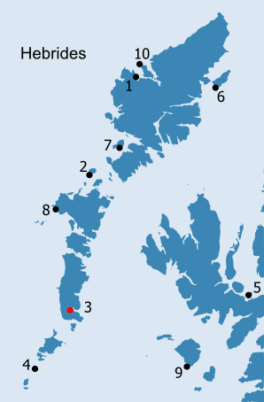
HEBRIDES: H3. Pabbay/Pabaigh · Introduction centred NF 7779 1964 Introduction Pabaigh/Pabbay lies at the north-west, innermost corner of Loch Boisdale/Baghasdail, 'one of the best, safest, and most capacious harbours in the kingdom' (MacLean 1837, 195). This sea loch almost bisects South Uist in two and was of some strategic importance, attested by the presence of a castle on the island of Calvay/Calbhaigh guarding the entrance to the loch from the Minch, now replaced by a lighthouse (Anon. c.1630, 181; Macculloch 1819, 96; Macculloch 1824, 24; NMRS no. NF81NW 1; NF 8175 1811; Figs. H3.1 and H3.2). Boisdale appears to have been linked with Eriskay and Barra, until acquired by Clanranald, the owner of the larger part of South Uist, in the early seventeenth century; this boundary is still visible on Bald's estate plan of 1825, running into the south west corner of Loch Baghasdail (OPS, 366-7; cf. Anon. c.1630, 181; Mackenzie 1932, 286; Fig. H3.3). Clanranald ownership of South Uist has ensured that, like the isles to the south, it has remained Roman Catholic.
South Uist is divided into three geographical zones: a mountainous east coast, dominated by peat and small lochans, a narrow central strip known as the 'blacklands', with thin acidic soils formed from peat which can be improved by manuring and the addition of shell sand, at least where these are easily available, and the fertile machair forming the western coastal strip (Munro 1793, 291; Macdonald 1811, 784-5; MacLean 1837, 186-7; Mackay 1980, 74; Parker Pearson, Sharples and Symonds 2004, 9). The appearance of the different parts of the island are summarised succinctly by Macculloch:
South Uist (West) is a large island, being twenty miles long and nine wide where it is broadest. It is an epitome of all the rest ; a strange collection of sands, bogs, lakes, mountains, sea lochs and island. The western shore is flat, sandy and arable, and nothing can exceed the dreariness of its appearance after the crops have been removed. That is followed by a boggy, brown tract of flat and low hills interspersed with lakes, which is again succeeded by high mountains ; and these, descending to the sea on the east side, are intersected by inlets so covered with islands, that we are often at a loss to know whether land or water predominates. . From the high land above Loch Boisdale, it is easy to form a conception of the manner in which the islands are distributed along the eastern shore of this chain. The whole of this fine inlet is so covered with them that although they are sufficiently distinct when thus seen in a bird's eye view, it is impossible, when among them, to conjecture the extent of the water, and no less so to distinguish one from the other, or to find the way through them (Macculloch 1824, 21-3).
Pabbay/Pabaigh is underlain by gneiss and is located in the central geographical zone, on the 'blacklands', but at one of the narrower points of South Uist. This allows relatively easy access to all of the resources on the island and gives the impression that Pabaigh is in a central location; if remoteness had been essential, then there are islands further out in Loch Baghasdail which would have served this purpose (e.g. Eileanan Iasgaich, the 'fish' or 'fishing islands'; the name may have arisen from the narrow channel between the largest of the islands, which acts as a natural fish trap (Haswell-Smith 2004, 234). The islands to the south of Pabaigh, which are also tidal, are called Eilean nan Imireachean, 'island of the processions' (ibid.; Fig. H3.3). The present settlement of Lochboisdale, although a relatively late creation as a result of the fishing boom, lies just to the east of Pabaigh, while crofts line the north shore of the loch.
The crofting settlement of Baghasdail now lies on the eastern edge of the machair, around 3km to the west of the south west corner of Loch Baghasdail, although Bald's early nineteenth century estate map shows that it was originally located on the machair itself.
At the summit of the southern part of Pabbay/Pabaigh and lying to the east of a prominent outcrop of bedrock is a large mound (SMR 10066; NMRS NF 71NE25). At the top of this mound, is a sub-circular cellular structure, measuring around 4m x 5m internally and now heavily overgrown (Raven 2003; Fig. H3.5). Another two or three probable cells, also now overgrown with turf, lie to the north and east, lower down the slope. The upper cell could be 'a badly built or denuded blackhouse', but could as easily be of earlier date (ibid). Like the cellular structures on Pabaigh Beag, Uig, in Lewis (see H1), it is possible that this is an early monastic establishment, as suggested by Parker Pearson et al. (2004, 122-3).
OS maps: Ordnance Survey, 2003. 1:25,000. Explorer 453 (Benbecula & South Uist/Beinn na Faoghla agus Uibhist a Deas. Eriskay/Eiriosgaigh). Edition A. Ordnance Survey, 1878. Original Object Name Books. Inverness-shire. South Uist. Book 12. NAS RH4/23/109. Institute of Geological Sciences, 1981. 1:100,000. The Outer Hebrides. Uist and Barra South. Solid Edition.
This 'papar' island in S.Uist is an anomaly among all the known Pabbays and Papays. It is of no agricultural value, and situated in a totally different type of location, in the sheltered inner reaches of Loch Boisdale/Baghasdail. This opens onto the Minch, and is therefore easily accessible by boat, but is not on any sort of sailing route. The islands are tidal and so accessible in a way that no other papar island is. As Haswell-Smith notes (2004, 234) 'it is out of character for a Pabbay.to be tidal', adding that this would allow the hermit to be more sociable than usual (!) However, as the present study suggests, inaccessibility is not the most important criteria of 'papar' islands, although productivity is. In this respect this Pabbay/Pabaigh's central location in South Uist and with access to the resources of surrounding communities may be significant. It could perhaps have functioned as a transit point, for the collection of resources from the fertile machair lands around Cille Pheadair to the sheltered waters of Loch Baghasdail. The recently-recorded (possible) monastic cellular structures might provide important evidence if excavated. |
|||||||||||
)
)
)
)
)