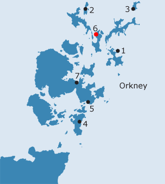
ORKNEY: O6. Papley, Eday · Introduction
In the late nineteenth century, Papleyhouse is described as a small farmhouse in the district of Cousbay, on the north west coast of Eday (NB, Orkney, Book 4, 30). The name is still extant. Marwick, who is one of the few writers to mention the name, was not aware of any traditions associated with what he describes as a small croft (1952, 50), and he sounds a note of caution about its significance, which could have arisen from the name of a man ‘who built it or lived there in comparatively recent times’. Eday is the least fertile of the northern isles - it was noted as a supplier of peat and of part of the sandstone utilised to build St. Magnus’s cathedral (Brand 1701, 55; Low 1778, 140). The island’s name most probably derives from aith, referring to the broad sandy isthmus dividing the island (Marwick 1952, 48), the writer of the New Statistical Account believed it to be a corruption of ‘heath’ (Simpson 1841, 157). Three quarters of the island was once common land, while conservation measures to restrict the export of both peat and turf were in place by the 1790’s (Fenton 1978, 50, 210-14). In 1595, the whole of the Yle of Ethay was set in feu by Adam, Bishop of Orkney to Edward Sinclair for ‘5 lasts flesche and 16 pounds money’, confirming the emphasis on an animal, rather than a crop based, economy (Peterkin, no. II, 71). In this context, it is noticeable that Cusug is depicted as lying within its own enclosure on Aberdeen’s map of 1769 and, since it is one of very few names on this map, this would suggest it was a settlement of some importance. Similarly, the OS First edition map shows a concentration of small farms clustered around the northern end of the bay, reflecting perhaps an area of better ground backed by open hill to the north and east, and this part of the island does rate a Soil Survey Class 42. The west side of the island at this point contrasts markedly with the pattern of large, square fields lying around Carrick House, seat of the island’s proprietor, on the opposite side of the island and overlooking the sheltered harbour formed by the Calf of Eday (Low 1778, 141; Gorrie 1869, 176; RCAHMS 1946, 53, no. 210; Burgher 1991, 92-3; NMRS no. HY53NE4, HY 5668 3847). The discovery of Iron Age pottery just to the north of Cousbay attests to early occupation in this area (NMRS no. HY53NE34, HY 5568 3883).
Eday, with its dependant chapel on Faray, appears to have been conjoined at an early date with Stronsay (FES, Vol. VII, 261; Cowan 1967, 58). The parsonage revenues of Eday and Faray, along with Our Lady and St. Peter’s, Stronsay, pertained to the mensa of the bishop of Orkney from a similarly early date and remained so at the Reformation (Cowan 1967, 58). In 1544, the vicarage teinds were assigned to the treasurer of Orkney, although the vicarage seems to have retained its independence (ibid.). Brand mentions the existence of two churches in the united parish, one of which was on Eday, although this was only preached in on every third Sunday (1701, 55). By the end of the same century, five churches were recorded within the conjoint parishes; In addition to one on Eday, there were three on Stronsay, while the fifth was on the pasture isle of Pharay or Faray (Anderson 1794, 418-9; cf. Monteith 1845, 7). Eday’s church - the Lady Kirk at Skaill - seems to have been rebuilt in 1730, but was ruinous by 1779; when described in the 1790s, ‘it had not a pane of glass in any of its windows in the memory of any man living’ (Anderson 1794, 424) and was rebuilt again in 1858. Anderson’s implication that the minister would not travel to Eday, unless the church was repaired, is confirmed to some extent by the later Statistical Account, when the minister was only visiting the island on every fourth Sunday (Simpson 1841, 166). In 1778, the Lady Kirk is described as possessing a barrel vaulted choir (Low 1778, 140), while Neale states that it ‘must have been the gem of the parish churches of the Orkneys. It was First-Pointed, and consisted of chancel and nave, with bell-tower. The chancel was vaulted seemingly in two bays: and in a style far superior to the usual ecclesiology of the Orkneys’ (1848, 111). The only possible traces of this building are the large freestone blocks built into the churchyard dyke (RCAHMS 1946, 64, no. 238; RCAHMS 1984, 15; NMRS no. HY53SE1, SMR no. OR 985, HY 5680 3287). That this was an early site is confirmed by the discovery of six fragments of a whinstone cross-slab in the first half of the twentieth century; the fragments are all now lost, but are possibly of pre-Norse date (RCAHMS 1946, 52-3, no. 209; RCAHMS 1984, 15, no. 49; Burgher 1991, 94; Fisher 2002, 47-8). The surface of the slab was adorned with a deeply incised cross, having an expanded square centre, D-shaped terminals and a pedestalled base; the shaft of the cross continues towards the now missing base of the cross, while the slab tapers slightly towards the top (RCAHMS 1946, 52, no. 209 (3); Fisher 2002, 47-8, fig. 3.6). This is one of three carved slabs, found at a depth of about six feet below the present surface of the graveyard, but is by far the earliest in date (RCAHMS 1946, 52-3). Skaill is located on the south east side of Eday; the only other recorded chapel lies on the south coast of the island. Hannah’s Kirk lay at the bottom of the home pasture field of the farm of Greentoft; a few small stretches of well-laid stonework were visible in the eroded face of the cliff edge, but were destroyed during a gale in 1984 (NB, Orkney, Book 4, 138; Clouston 1918, 239; RCAHMS 1946, 64, no. 239; RCAHMS 1984, 15, no. 48; NMRS no. HY52NE5, SMR no. OR 1000). A mound presumably representing the remains of a chapel survives in the south east corner of the disused burial ground on Faray (Clouston 1918, 239; RCAHMS 1946, 72, no. 256; RCAHMS 1984, 20, no. 84; NMRS no. HY53NW3, SMR no. OR 731), while traditionally a monastery was located at The Graand on the Calf of Eday, where all that is visible today is a number of sheep shelters (RCAHMS 1946, 72, no. 252; RCAHMS 1984, 19, no. 78; NMRS no. HY53NE24, SMR no. OR 982). Although Low noted that there were ‘many small Chapels round the island … all in ruins’ (1778, 140), there is little to confirm his statement; the author of the Old Statistical Account mentions a ruined chapel on Eday (OSA, 327) - possibly Hannah’s Kirk - and Clouston postulates a chapel close to Lady Kirk (1918, 239). The only other intimation of a religious site on Eday itself is the placename, Bredakirk, taken to derive from St. Bride’s Kirk (Marwick 1927, 65; Marwick 1952, 48). This applies to a small croft; it appears on the modern OS 1:10000 map and is shown on the First edition as Bradakirk. While described as neighbouring Papleyhouse by Marwick (1952, 48), it does lie some distance to the south of Cusbay, in the township of Guith, at the head of the Bay of Newark.
It is very difficult indeed to draw any certain conclusions about the significance of this name which is unrecorded before the nineteenth century, especially when there is no known ecclesiastical site nearby, or associated sculpture. It could indeed, as has been suggested, be derived from a family called Paplay (a well-known Orkney surname), as other places in Eday had a ‘house’ name combined with the surname of the family which lived, or had lived, there.29
· Soil Survey of Scotland Class 42
OS maps:
| ||||||||||
| 29Information passed on by W. Thomson from a local historian |
||||||||||