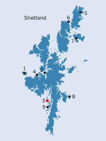
SHETLAND: S3. Papa, Burra HU 364 376 · Introduction Papa is a very small uninhabited island off the north-west side of West Burra, lying on the south side of the sea route leading into Scalloway, the ancient capital of Shetland. Like the larger Papa Little, Papa is named on several of the earlier maps of Shetland (Blaeu 1654; Collins ?1693a; Keulen 1727; Moll 1745b; Preston 1781; Depot Generale de la Marine 1803b; Arrowsmith 1807; Thomson 1827; Blachford 1846; it appears to be drawn on Gordon’s map of c. 1636-1652, but is not named). The OS First edition map (1878) depicts a number of names on the island itself which incorporate the ‘papa’ element . Close to the north east tip of the island is the Hogg of Papa, while rocks further to the north-east were known as Papa Skerray. The East Head of Papa is matched by the West Head of Papa on the opposite side of the island. The Land Capability value of 62 means that this island is only capable of use as rough grazing, and its importance as sheep pasture is evident from the first documentary references to it in the late sixteenth century. In 1589 ‘the holm(s) of Papa..beside Skalloway’ was reserved by Robert earl of Orkney along with some other important and formerly royal lands throughout Shetland for his own use (Ballantyne and Smith, 1999, 132). in 1597 there was a doom and ordinance of the lawting court ‘tueching the greit stowth of scheip taine out of my lordis holmis callit Papay and Hildissay..out of Papay four scoir or thairby’ (ibid. 262). These holms were of course conveniently located for the earl’s power centre of Scalloway. Sibbald describes the island as affording ‘good Grass for the fatning of Sheep’, but somewhat infested with rabbits (1711, 57). Low notes that all of the small islands off Scalloway were ‘pretty well situate for fishing on the west Hav ; most of them well provided with pasture’ (1774, 189). These factors are also mentioned in a description of the island dating from c.1772 (rental of Shetland by William Balfour). When the OSA was compiled, Papa appears to have been associated with the areas of Burra and Havera; this district as a whole had 28 boats of a ‘lesser size’ for fishing (Menzies 1792, 196). It would seem probable that the eighteenth century administrative linking of these islands off the west coast of the mainland reflects earlier arrangements, but does not account for why Papa, ‘a small spot inhabited by two families’ (Marshall 1841, 9) is named at all, given the number of similarly sized islands - including Havera - in the area. There do not appear to be any archaeological features on Papa, and the main structures recorded on the 1st ed. OS are near the East Head, where the only settlement was located. Several isolated sheepfolds and an unannotated square enclosure are spread out over the rest of the island. By the time revisions were undertaken for the Second edition map, only the main cluster appears to have been still in use.
In the medieval period Papa was within the parish of Burra with its chief church at Papil. The parish of Burra was united with Quarff and Bressay in the sixteenth century, when the bishop of Orkney possessed half the corn teind of the parsonage, the residual teinds being reserved to the vicar (Goudie 1910, 306; Cowan 1967, 23). Pitcairne states that, soon after the Reformation, ‘Thair is bot twa kirkis of olde and remains as yet ane kirk in ilk iyle’, while there had been no minister for fifteen years in the united parishes (1605-1617, 156). Following the Reformation, there appear to have been separate sessions associated with each of the two churches in the parish (Menzies 1792, 198; Marshall 1841, 14), although only one minister serving all three parishes is mentioned by Sibbald at the beginning of the eighteenth century (1711, 27). The church of Burra at Papil was dedicated to St. Laurence and had a round tower, apparently similar to that at St. Magnus on Egilsay (FES, Vol. VII, 287; see Site 9). The church of Bressay at Culbinsburgh, in which the ogham-inscribed Bressay stone - possibly a crude copy of the Papil stone - was found in 1864, was the head church for the parish of Bressay (Muir 1885, 133-4; Dryden 1896, 157-9; RCAHMS 1946, no. 1083; Fisher 2002, 55). Quarff may always have been associated with Burra, as it does not appear to have had a place of worship until a parliamentary church was built in around 1826 (Cant 1976, 19; FES, Vol. VII, 287); however, Sibbald does mention a chapel of Easter Quarff and the present church lies within an older graveyard (1711, 58; RCAHMS 1946, no. 1256). No ecclesiastical sites have been recorded on Papa, although a kirk site and two possible chapel sites are annotated on the Shetland Museum's copy of the 2nd ed. OS map (information from Shetland Amenity Trust). Its recorded importance as sheep pasture may suggest that it was earlier exploited in conjunction with the richer lands around Papil on West Burra as suggested by Lamb (1995, 16). This could be the reason for its naming as a Papa island.
· Soil Survey of Scotland Land Capability; Class 62
OS maps: |
||||||