
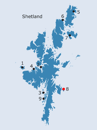
SHETLAND: S8. Papil Geo, Isle of Noss, Bressay · Introduction The island of Noss is described by Sibbald as mostly pasture, ‘stored with Bestial, and there is considerable Corn Land in it for so much bounds’ (1711, 62). Low also noted that he ‘Crossed a small but rapid sound for Noss, a fine island, covered with verdure and well cultivated’, while, as on Bressay, the crops appeared more forward than in other areas of Shetland at the time of his visit (1774, 191, 193). On the rocky shoreline forming the north coast of the island of Noss and lying about 700 yards to the north-east of the chapel of Gungstie is the inlet of Papil Geo (NB, Shetland, Book 14, 35; Jakobsen 1936, 173; MacDonald and Laing 1969, 129). The inlet is not named on any of the maps prior to the OS First edition (1878), but this is no doubt due to the small scale of the earlier maps, which rarely include such detailed topographic names. On the earlier editions of the OS maps, the circular stack of Papilgeo lies to the east and the Hill of Papilgeo includes all the Improved ground to the south and south east of Papilgeo. If it is assumed that the Papil Geo name represents a landing place connected with the ‘papar’, then it may be significant that ‘there are better landing sites’ closer to the chapel of Gungstie (Turner 1998, 90; see below). However there have been great changes to the coastline around the sound and there may have been a connecting land-bridge between Bressay and Noss at the time the chapel was built, or the ‘papar’ were around (pers.com.Jonathan Wills). Moreover Papil Geo might have been the best landing place for access from the north, rather than broaching the narrow sound.
The chapel at Gungstie lies near the sound which separates Noss from nearby Bressay, at a height of between twenty or thirty feet above the sea (Dryden 1896, 146); on the opposite side of the narrow sound is the broch of Burgi Geo (NMRS no. HU54SW8). The site lies close to a shepherd’s cottage, near the main landing place for the island (RCAHMS 1946, no. 1110) (FIG. S8.1). A chapel was extant in 1711, when Sibbald reported that traditionally it was built by ‘Shipwrakt Persons, the time when and the Name of it is not known’ (Sibbald 1711, 30, 62). Similarly, Muir was told that the chapel was built by a ‘bestormed seaman who, in his extremity, had vowed “an altar unto the Lord,” wheresoever he might find a shore’ (1885, 71, 136). In 1774, the chapel was described as ‘small, but of neat workmanship, and the yard is still used as a burying ground. The walls still mostly entire’ (Low 1774, 193), while in 1841, it was described as ‘a small burying-ground …. lying round the fragments of what appears to have been a Popish chapel’ (Marshall 1841, 12). When the foundations of the chapel were planned in 1852, a fragment of the north wall of the chancel still stood to about four or five foot high, although the rest of the walls were only indicated by a ridge in the turf (Dryden 1896, 146). At this time, the nave measured 18ft 6 ins by 14ft, and the chancel about 12ft E to W, by 10ft N to S (ibid., 146-7). The walls of the church are now barely definable swellings in the turf, through which protrude an occasional stone and one or two fragments of walling (MacDonald and Laing 1969, 129, no. 4). The outline of the nave, measuring approximately 28ft N-S by 25ft E-W over very spread walls, with a narrower chancel, 18ft N-S by 17ft E-W attached to the east end, is still recognisable (ibid.). The graveyard, square in shape but apparently unenclosed, is marked by a number of flat slabs (some recumbent) of small or medium size, plus a few small boulders, on the south side of the church. Within the graveyard are two seventeenth century grave-slabs, with heraldic shields and emblems of mortality, although the inscriptions are illegible. A tiny, broken cross-slab, incised with an interlaced cross of very early type, was found at the edge of the graveyard in 1959 (Shetland Museum, accession no. ARC 66116; Fisher 2002, 54, contra Thomas’s belief that the slab came from the Holm of Noss (1971, 118-19), repeated by Lamb 1974, 84; NMRS no. HU53NE1, HU 550 391). The shaft and transoms of the cross are formed by triple incisions, while the rectangular terminals are open (Fisher 2002, 54).(FIG.S8.2). The fact that a number of stones have fallen over the cliff, onto the beach, suggests that the graveyard was once much more extensive. Damage caused by coastal erosion, particularly severe at the point where a drainage pipe had been cut through, had disturbed at least three skeletons at the cliff edge which were partially excavated in 1993, with further work carried out in this area in 1999 (Turner 1993, 93; Turner and Simpson 1999, 80). None of the skeletons appear to have been laid in a coffin or to have been wrapped in a shroud; at the north end of the site, on the edge of the bank, a slotted stone, likely to be a corner-post for a stone-slab shrine of early Christian type, was left in situ (Turner 1993, 93). Rescue excavation prior to coastal protection works in 1994, confirmed the identification of the corner post, although no further fragments were identified and it was not in its original setting (Turner 1994, 93). A broken rune stone suggested the continued use of the site during the Viking period, while the area had been intensively used and reused for burial, some of which had been in coffins (ibid.; Fisher 2002, 55). One skeleton was found lying across what appears to be part of the foundation and facing stones of a round tower. If this identification is correct, it may have been similar to those which once existed at Papil (see Site S9), Tingwall and Ireland (S. Shetland). If the chapel shared the same east-west orientation as those on Egilsay and at Papil, the rest of the church will have already fallen into the sea (ibid.). Subsequently, a rectangular grey sandstone slab with a broad, sunken cross with bar terminals has been recovered from the site (Watt and Tait 1996, 92). This is probably of Early Christian date and finds its closest parallels in the Hebrides (e.g. Pabbay) and on the north-west coast of Ireland (Fisher, 2002,54). The sculptural evidence proves beyond doubt that the chapel was of early Christian date, and the site continued into use - or was re-used - in the Norse period. We have therefore some strong evidence for the pre-Norse date of the chapel at Gungstie, and the existence of an inlet named after the ‘papar’ (Papil Geo) nearby would suggest that Gungstie was an original Papil site. It may have lost that name which was replaced by the more prosaic Gungstie (perhaps ON gang-stö∂, the second element meaning ‘landing-place’: Stewart, 1987, 262).51
The Kirk of Noss, along with St. John’s at Kirkabister and St. Olaf’s at Gunnista, was a dependent chapel of St. Mary’s at Culbinsburgh (Sibbald 1711, 60; FES, Vol. VII, 278; RCAHMS 1946, nos. 1103 and 1104; Cant 1976, 19). St. Mary’s, in which the ogham-inscribed Bressay stone - possibly a crude copy of the Burra Papil stone - was found in 1864, was the head church for the parish of Bressay (Muir 1885, 133-4; Dryden 1896, 157-9; RCAHMS 1946, no. 1083; Fisher 2002, 55). Both the chapels at Gungstie and Gunnista seem to have still been in use at the beginning of the eighteenth century, although St. John’s was ruinous (Sibbald 1711, 27, 60). In the NSA, three burying grounds are mentioned in Bressay. The oldest of these was believed by the author to be Gunista, while in addition to Noss, people were buried at Culbinsgarth [Culbinsburgh] (Marshall 1841, 12). The burial ground at Kirk of Noss had become disused by 1878 (NB, Shetland, Book 40, 43). The parish of Bressay was united with Quarff and Burra in the sixteenth century, when the bishop of Orkney possessed half the corn teind of the parsonage, the residual teinds being reserved to the vicar (Goudie 1910, 306; Cowan 1967, 23). Pitcairne states that, soon after the Reformation, ‘Thair is bot twa kirkis of olde and remains as yet ane kirk in rek ….’, while there had been no minister for fifteen years in the united parishes (1605-1617, 156). Burra, Bressay and Quarff may have been a single medieval ‘priests district’, but it is perhaps more likely in this case that each area formed a separate parish; in 1547, Sir Thomas Murray is named as curate of Bressay (Goudie 1904, 55; Cant 1976, 14, 19). Following the Reformation, there were separate sessions associated with each of the two churches in the parish (Menzies 1792, 198; Marshall 1841, 14), although only one minister serving all three parishes is mentioned by Sibbald (1711, 27). The church of Burra at Papil was dedicated to St. Laurence and apparently had a round tower similar to that at St. Magnus on Egilsay (FES, Vol. VII, 287; see Site 9). Quarff may always have been associated with Burra, as it does not appear to have had a place of worship until a parliamentary church was built in around 1826 (Cant 1976, 19; FES, Vol. VII, 287); however, Sibbald does mention a chapel of Easter Quarff and the present church lies within an older graveyard (1711, 58; RCAHMS 1946, no. 1256).
This survival of a ‘Papil’ name in a topographical context can probably be used as evidence for an early ecclesiastical site in the vicinity, and the early Christian sculpture discovered at Gungstie points to this church as being the ecclesiastical site in question (compare this with the incidence of ‘Papa Geo’ - Site S4). The early references to the quality of land on Noss (and the rental values?) should counter the low grade of land assessment in the Soil Survey.
· Soil Survey of Scotland Land Capability Class 52
OS maps:
|
||||||||||||||||||||
)
)